River Valley or Ridge Road: Two Ways Through a Region
Compare a river valley route with a ridge road to choose the corridor that best fits your journey, terrain, visibility, and connections.
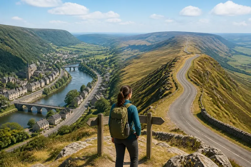
A river valley route and a ridge road can connect the same places while giving travelers very different views of the region. The choice between them is not simply low ground versus high ground: each corridor shapes what is visible, which settlements are close at hand, and how a journey relates to the land.
For a traveler deciding between them, the useful question is what the route needs to connect. A valley tends to link water, flatter ground, and communities gathered along the corridor. A ridge can offer a clearer line across varied terrain, with broad views and fewer immediate ties to the valley floor. Neither is automatically the easier or more direct choice.
Valley route character
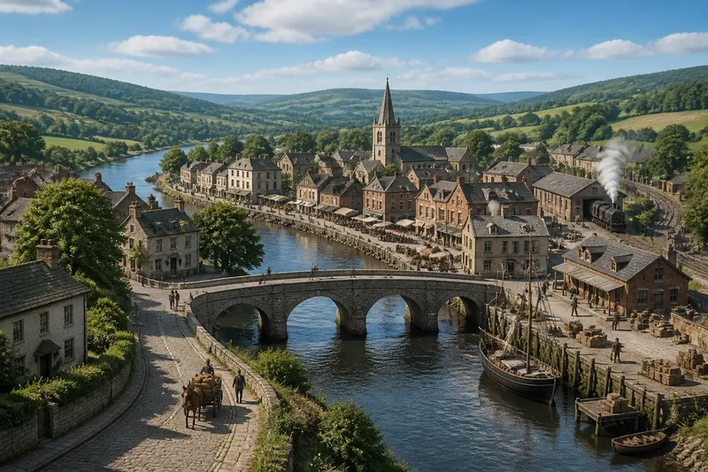
A river valley often provides a natural passage through uplands. The river has cut through higher ground, and roads, paths, or rail lines may follow the space beside it. Slopes on either side can limit detours, while the valley floor offers a relatively continuous corridor.
That continuity comes with close contact with the river and its settlements. A valley route may pass fields, bridges, industrial sites, and towns arranged along the water. The sequence can make the region legible as a chain: one settlement leads to the next, with the river serving as a recurring reference point.
The view is usually framed rather than expansive. A bend may hide what lies ahead; wooded slopes can screen neighboring districts. In a narrow valley, the road and river may share limited ground, and a crossing or constriction can become an important point of passage. The route feels connected because it follows the same land that supports nearby movement and settlement.
This corridor often suits someone whose destination lies along the valley or who values frequent connections to communities and crossings. It may be less appealing to a traveler seeking a broad overview or to one whose journey needs to avoid the valley’s bends and built-up stretches.
Ridge road character
A ridge road follows high ground rather than the river’s course. Depending on the terrain, it may trace a long crest, link several high points, or cross a rolling divide between watersheds. Its path can feel independent of the settlements below, even when those places remain visible.
Elevation changes the view and the sense of direction. From a ridge, a traveler may see several valleys and recognize how the land falls away on either side. A distant landmark can remain in view for longer than it would from a winding valley floor. That visibility makes the region easier to read at a glance, though a clear view does not mean a simple route.
Ridges can be exposed to wind and weather, and the road may rise and fall over uneven ground. Access to water, services, or nearby towns can be less immediate than along a settled valley. In some regions, however, the crest is the most continuous dry passage, while low ground is broken by wetlands, steep slopes, or a river that repeatedly requires crossing.
A ridge route may suit someone traveling between places on the high ground, seeking views across several parts of a region, or following a corridor that avoids a winding valley. It may be a poor fit when the destination is down by the river or when frequent access to valley communities matters more than a wider outlook.
What changes the choice?
The terrain matters, but so does the purpose of the trip. Compare these features before choosing a corridor:
- Destination: Check whether the places you need to reach sit on the valley floor, along the crest, or on side roads between them.
- Route shape: Look at bends, climbs, and crossings on a map. A route that appears straight may involve a steep approach or a long descent.
- Visibility: Consider whether you want a broad view of the region or a route that stays close to its settlements and landmarks.
- Connections: Note where roads, paths, bridges, and transit links join the corridor. A route’s usefulness often depends on these points, not just its main line.
- Conditions: Check current local guidance for closures or weather concerns, especially on exposed high ground or near a river. Use the relevant local and route information for the journey.
Say you are choosing between a valley road and a ridge road to reach a village on the far side of a range. If the village lies beside the river and the valley road passes its bridge, that corridor may provide the more direct connection. If the destination is near the crest and the valley road loops around a bend, the ridge may better match the journey, provided its climbs and access points suit your plans. The map gives the starting point; the destination and route conditions settle the decision.
Which route fits you?
Which route is more direct?
Neither is always more direct. A river’s bends can lengthen a valley route, while a ridge road may climb and descend around high points; compare the actual map line and access roads.
Which route offers better views?
Ridge roads generally provide broader views across the surrounding terrain. Valleys tend to frame the view along the river and may reveal settlements, crossings, and land use more closely.
Which route connects more towns?
Valley corridors often pass settlements clustered beside water and flatter land. A ridge road can connect high-ground communities, but may leave valley towns below and require a separate descent.
Can both routes serve one journey?
Yes, when roads or paths link the valley and ridge at accessible points. A loop or crossing route can show how the same region looks from its settled floor and its higher divide.
Reading the corridor
A route is more than a line between two points; it is a way of encountering a region. The valley makes connection tangible through water, crossings, and nearby communities. The ridge makes shape visible, revealing divides and distances that can be hard to read from below. Like choosing a window seat, the view changes what you notice, but it does not change where the road goes.
To choose a river valley route or ridge road, begin with the places you need to connect, then weigh access, terrain, and the kind of view that helps you understand the journey. If the route itself is part of the purpose, consider using one corridor in each direction. The contrast can explain the region more clearly than either view alone.